Structured aerial mapping for planning, development and site review
Certified Drone Pilots Ltd provides RTK-supported aerial mapping and orthomosaic outputs for land, development and infrastructure projects where a more structured spatial record is required than conventional aerial photography alone.
Using carefully planned overlapping image capture, photogrammetric processing and RTK-enabled workflows where appropriate, we can create detailed top-down site imagery that supports site review, planning discussions, progress comparison, contextual measurement and GIS-based workflows.
The capture method is selected according to the question being asked, the site environment and the level of spatial confidence required.
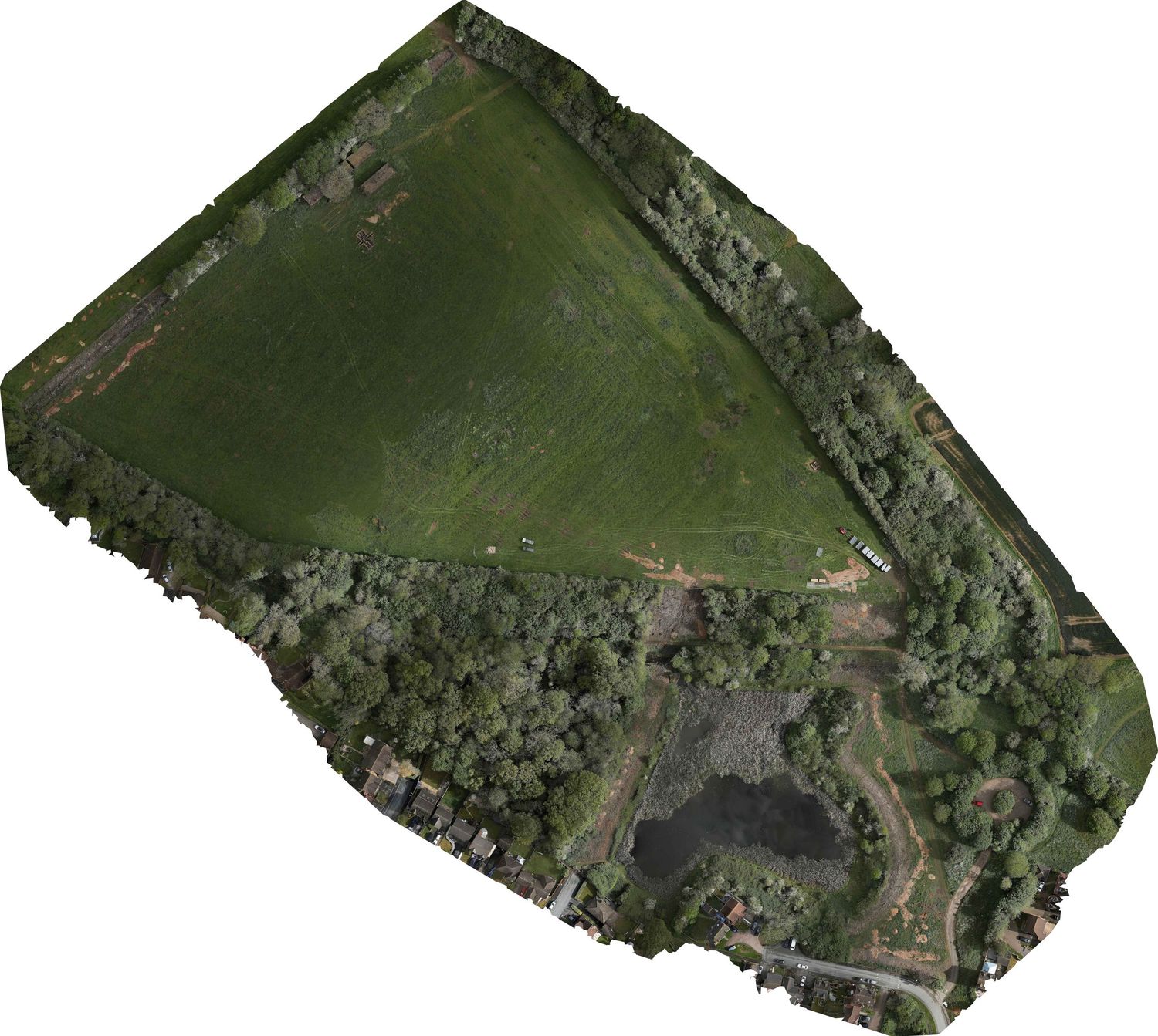
What is an Orthomosaic
a georeferenced top-down site image created from aerial photosUnlike a conventional aerial photograph, the image is corrected through photogrammetric processing so that features across the site can be viewed in a consistent spatial context.
Depending on the project, this can help teams review:
site layout and access
building and land relationships
development areas
visible boundaries and features
roads and surrounding context
vegetation and surface conditions
repeat site changes over time
indicative distances and areas where appropriate
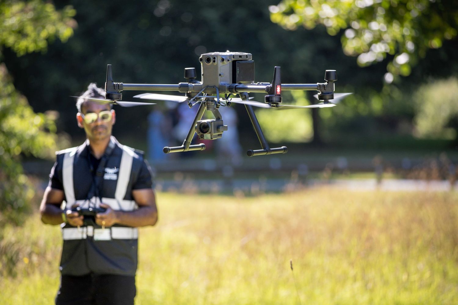
RTK-supported capture
The exact approach depends on the intended useFor projects requiring greater positional consistency and repeatability, CDP can deploy RTK-enabled aircraft such as the DJI Matrice 300 RTK with Zenmuse P1, alongside appropriate mission planning and control methods.
RTK can improve the georeferencing of the captured imagery and support more structured photogrammetric outputs.
Where the project requires it, workflows may also incorporate:
Ground Control Points · Check Points · Repeatable flight planning · GIS integration · Additional field observations
Typical applications
- Land Acquisition & Development
Create an up-to-date visual and spatial record of a proposed development or acquisition site to support internal review and stakeholder discussion.
- Planning Context
Understand the relationship between the site, roads, neighbouring development, access routes, visible constraints and surrounding land uses.
- Construction & Progress Monitoring
Repeat the same mapping workflow at defined intervals to create a consistent record of visible site change.
- Estate & Asset Management
Maintain current aerial records of larger estates, compounds, facilities or landholdings.
- GIS & Project Coordination
Provide georeferenced imagery that can be incorporated into GIS or other project workflows for contextual analysis and communication.
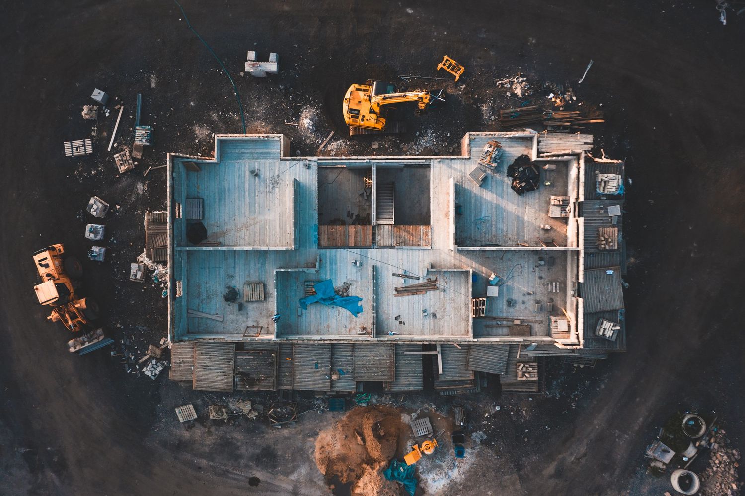
Outputs can include
Depending on the project requirement- High-resolution orthomosaic
- Georeferenced raster imagery
- RTK-supported photogrammetric dataset
- Relative elevation or surface model
- Hillshade and slope visualisation
- Contour outputs where appropriate
- 3D photogrammetric model
- Annotated site imagery
- GIS-compatible files
- Interactive web delivery
- Repeat comparison datasets


Relative elevation & surface context
Photogrammetry can also generate surface models that help visualise relative levels, slopes and surface relationships across a site.
These outputs can be useful for early-stage spatial understanding and for identifying areas that may warrant further investigation by the relevant specialist.
They should not be interpreted as formal drainage, flood-risk, geotechnical or engineering conclusions.
Repeatable site mapping
One of the main advantages of a structured aerial mapping workflow is the ability to repeat it.
Where appropriate, CDP can plan subsequent visits using consistent capture parameters, allowing project teams to compare site conditions at different dates.
This may support:
- development progress review
- land-management records
- before-and-after comparison
- vegetation or surface change review
- stakeholder reporting
- evidence retention

*Proud Member of Drone Pilots UK
Choosing the right evidence level
RTK mapping is not automatically required for every project.
For some questions, conventional aerial imagery or targeted ground-level evidence may be sufficient.
For others, an orthomosaic provides a more useful spatial record.
Where the decision requires greater positional confidence, repeatability or structured geospatial data, an RTK-supported workflow may be appropriate.
Our aim is to provide the level of evidence that is proportionate to the decision being made, rather than defaulting to the most complex capture method.
Example workflow
1. Project question
What does the client need to understand or decide?
2. Desktop & site review
Assess site size, context, access, airspace, environment and required outputs.
3. Capture specification
Select aircraft, altitude, overlap, camera configuration, RTK/control approach and supporting imagery.
4. Field acquisition
Structured image capture carried out under CDP's operational procedures.
5. Photogrammetric processing
Generate the appropriate orthomosaic, surface and/or 3D outputs.
6. Delivery & review
Provide decision-focused outputs through PDF, GIS-compatible data, imagery or interactive platforms as appropriate.
Technical & operational capability
CDP's mapping workflows are supported by:
DJI Matrice 300 RTK · Zenmuse P1 · Smaller UAS platforms · RTK-enabled workflows · Ground control where required · Photogrammetry processing · QGIS-supported analysis · Nationwide commercial operations
All UAS operations remain subject to airspace, regulatory, weather and site-specific feasibility.
Important accuracy note
The accuracy and suitability of any photogrammetric output depend on factors including:
- aircraft and camera
- capture altitude
- image geometry and overlap
- RTK/GNSS conditions
- ground-control methodology
- terrain and vegetation
- processing workflow
- required end use
Ground Sampling Distance (GSD) should not be treated as equivalent to independently validated absolute positional accuracy.
Where a project requires formal topographical survey, legally defined boundary information, engineering certification or another regulated professional output, an appropriate survey or specialist methodology should be specified.
Discuss a Mapping Requirement
If you have a land, development or infrastructure project and are unsure whether you need simple aerial imagery, an orthomosaic, RTK mapping or a more specialist survey, tell us what decision you are trying to support.
We can recommend an appropriate evidence approach.
Discuss Your Project

Proportionate Evidence
Different site questions require different evidence levels. CDP's commercial experience across acquisition, development and site-intelligence projects has increasingly focused on selecting the minimum sufficient evidence required to support a decision.
This experience is also informing our current CDP ORBIT VERIFY research and development work.