Oadby Grange – Aerial Site Intelligence Overview
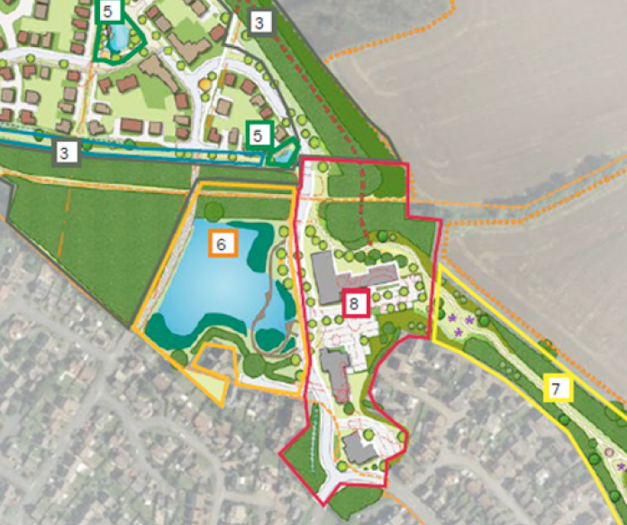
Proposed Development Layout (Planning Reference)
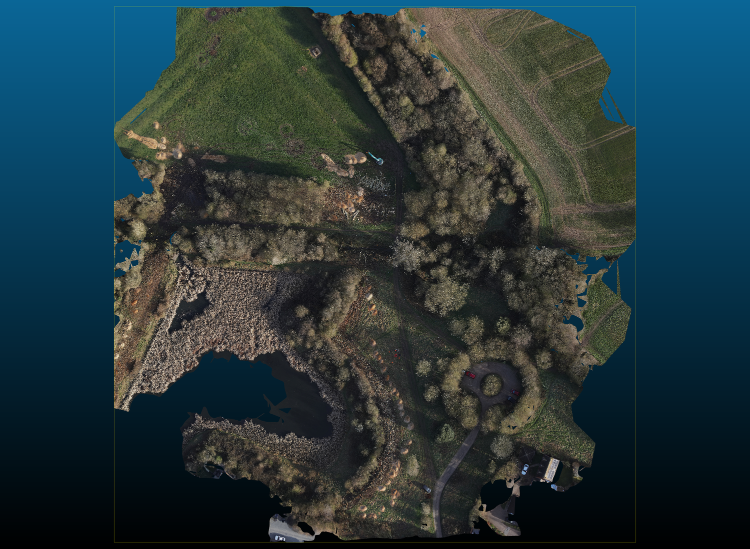
Current Site Condition - High-Resolution Orthomosaic
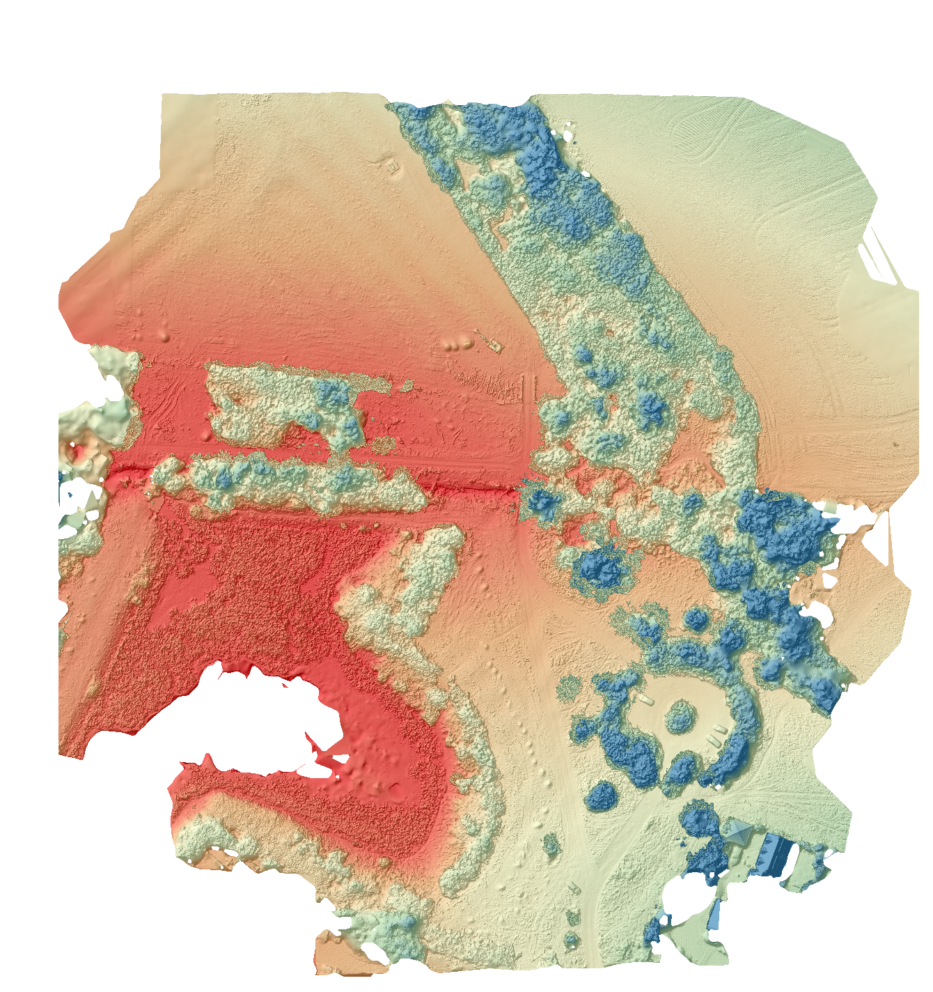
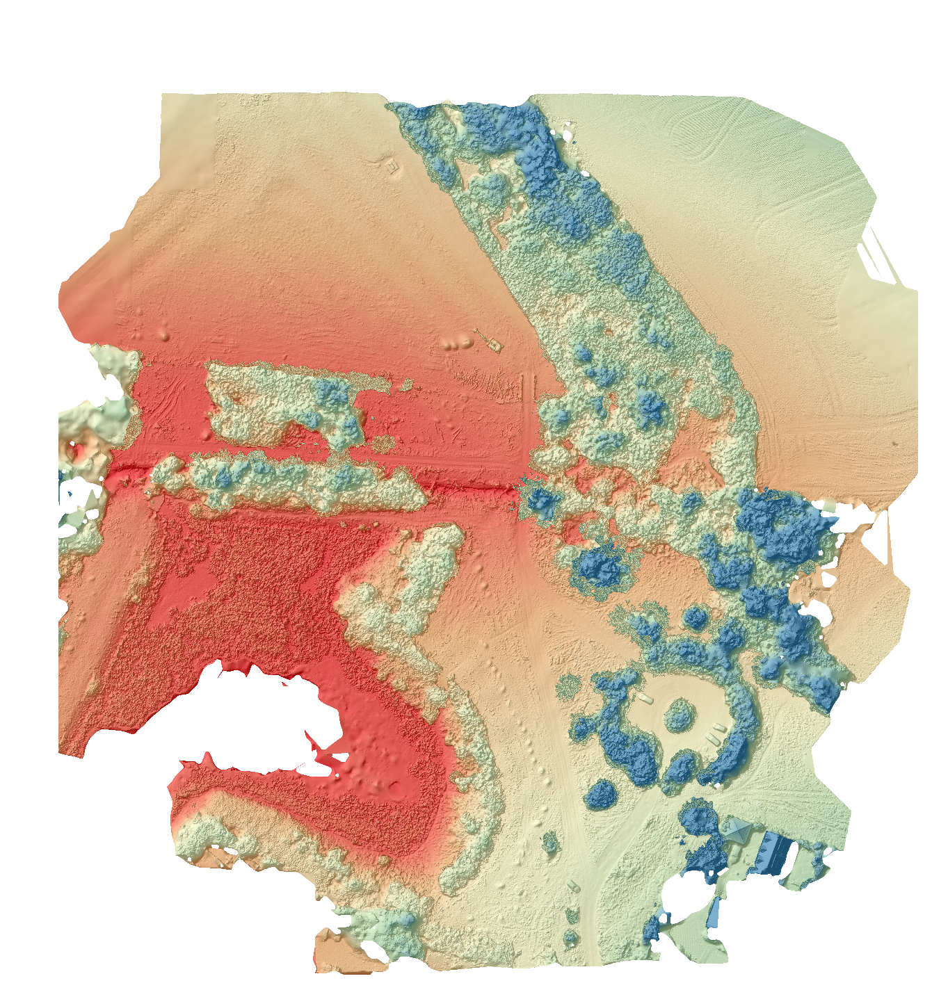
Elevation & Terrain Analysis (RTK Drone Data)
TERRAIN INTERPRETATION:
Red = Lower ground levels/potential water flow zones
Amber = Buildable / level terrain
Blue = Higher elevation (trees / raised features)
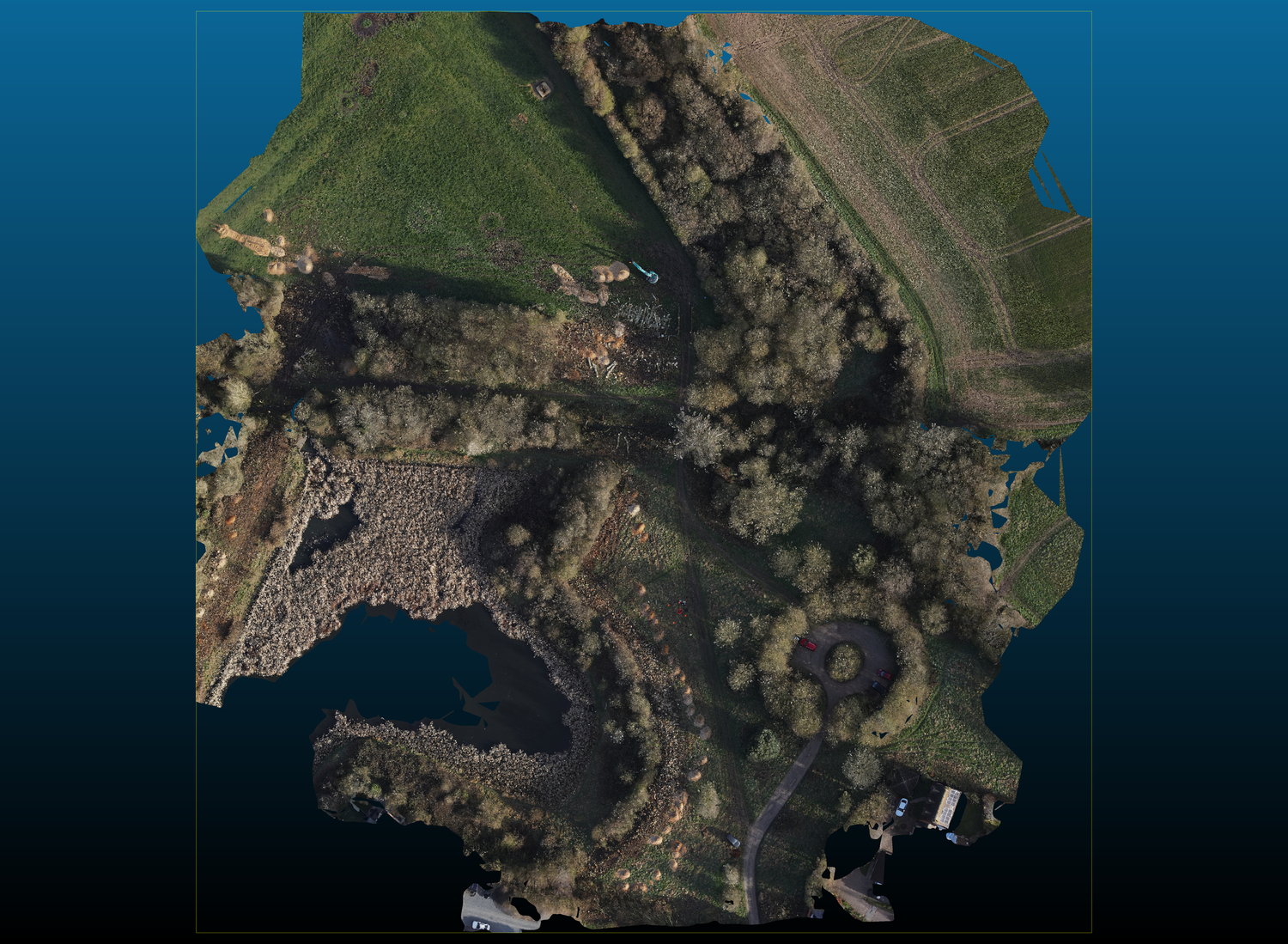
RTK Orthomosaic Mapping for Early-Stage Construction Monitoring
Aerial Site Intelligence OutputsThe aerial survey generated a suite of high-value outputs designed to support developers, planners and technical teams throughout the lifecycle of the project.
• High-resolution orthomosaic site map
• Detailed elevation (height) model with colour grading
• Hillshade terrain visualisation highlighting ground form and surface detail
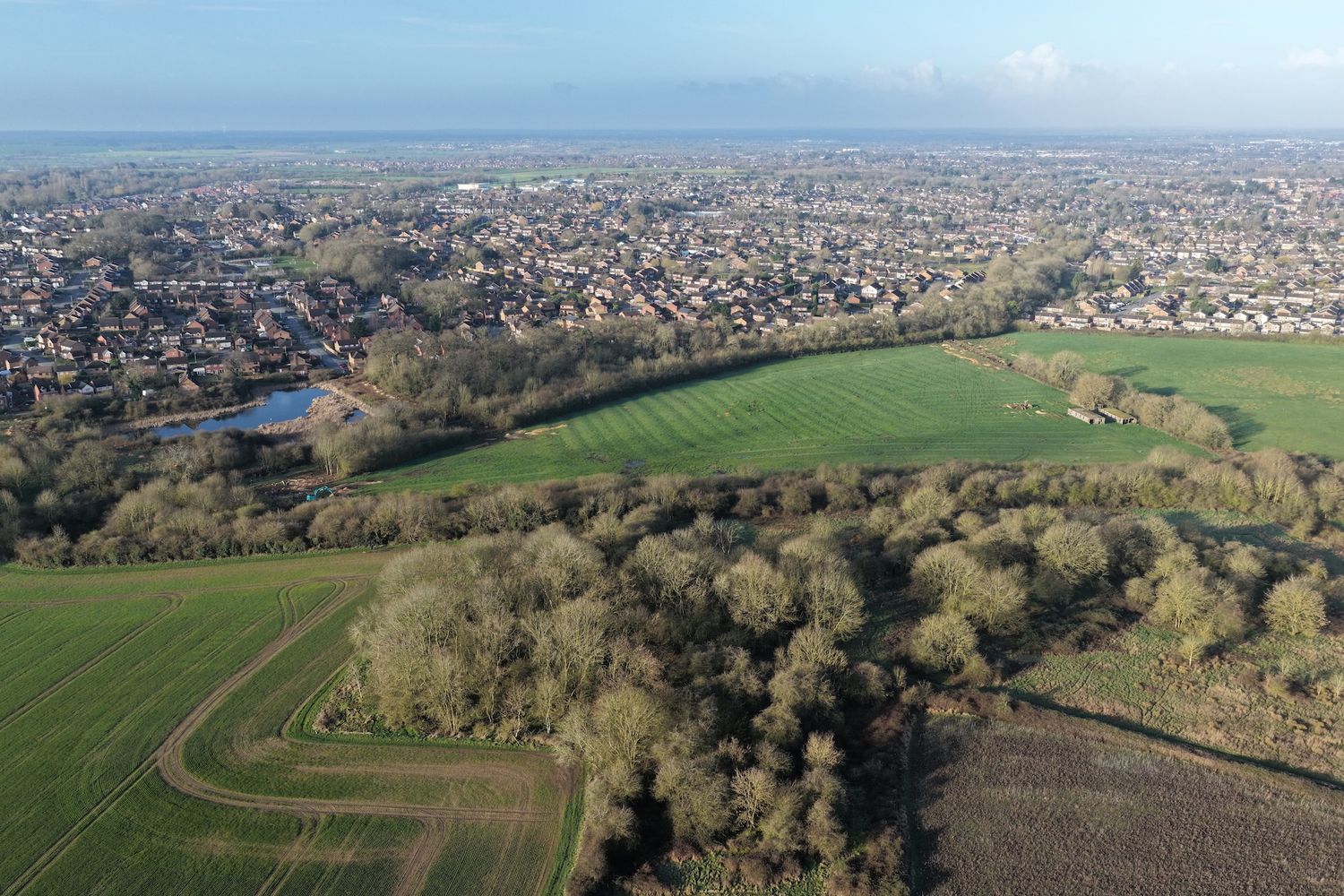
• Aerial overview imagery of the development area
• Baseline site condition data for future comparison
• Visual intelligence datasets for ongoing monitoring and analysis
Elevation & Terrain Analysis
A key deliverable from the survey is the colour-coded elevation model, designed to clearly communicate variations in ground levels across the site.
- 🔴 Red areas represent lower ground levels (e.g. water bodies, depressions)
- 🟠🟡 Orange / yellow areas indicate mid-level terrain and buildable ground
- 🔵 Blue areas highlight higher elevations, typically tree canopies or raised features
This visualisation allows developers and engineers to quickly understand:
- terrain variation across the site
- potential cut and fill requirements
- relationships between natural features and proposed build zones
Hillshade Terrain Visualisation
This output is particularly valuable for:• Identifying subtle changes in ground levels
• Visualising slopes, gradients and drainage patterns
• Understanding how the land will behave during earthworks
• Presenting site conditions clearly to stakeholders and decision-makers
Combined with elevation data, the hillshade creates a powerful, intuitive view of the site that goes far beyond traditional plans.
Our Approach
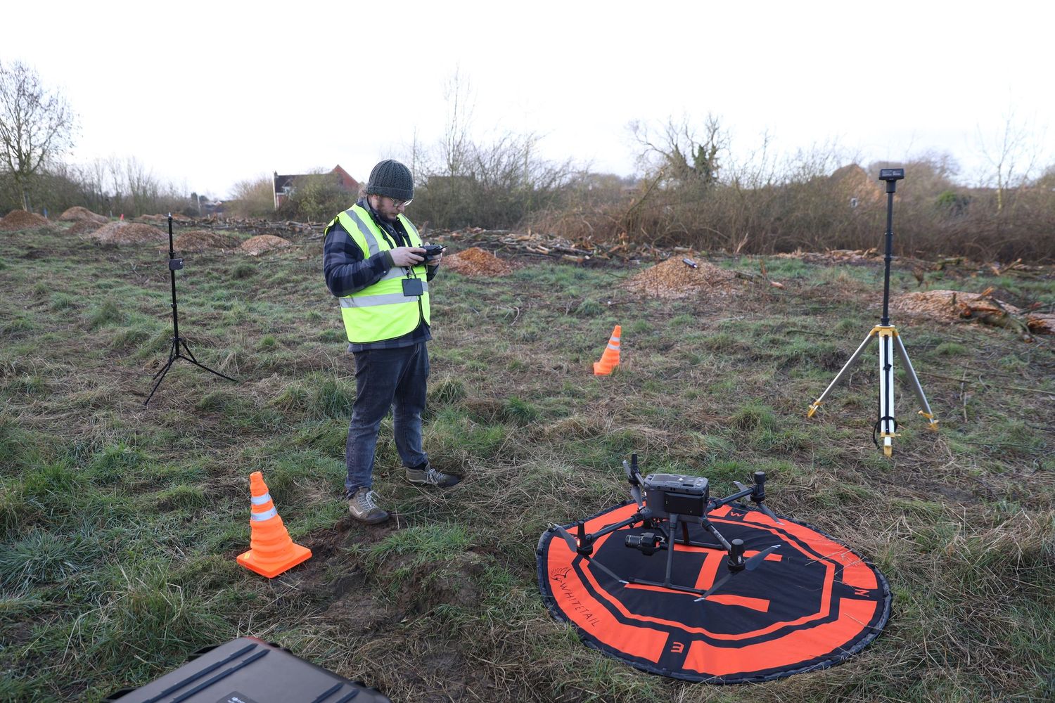
To capture accurate aerial survey data, a DJI Matrice 300 RTK equipped with a Zenmuse P1 was deployed.
The aircraft flew an automated mapping mission across the development site, capturing high-resolution imagery suitable for photogrammetric processing.
Technology
key technical details• RTK-enabled drone platform for enhanced positional accuracy
• Automated mapping flight planning
• Nadir imagery capture for orthomosaic generation
• High-overlap aerial image acquisition
• Consistent flight altitude for uniform resolution
The imagery dataset was processed to generate a georeferenced orthomosaic map, providing a seamless high-resolution aerial representation of the entire site.
Visual Outputs
1️⃣ Orthomosaic site map (true-to-scale)
2️⃣ Elevation model (colour-coded terrain analysis)
3️⃣ Hillshade terrain visual (3D surface detail)
4️⃣ Aerial overview imagery
Why This Matters for Developers
Drone-based site intelligence provides a fast, accurate and scalable way to understand and monitor development sites.
Regular aerial surveys support:
- Monitoring earthworks and land preparation
- Assessing terrain suitability for construction
- Tracking infrastructure and drainage development
- Maintaining planning and compliance records
- Improving coordination across project teams
High-resolution datasets also allow teams to:
- measure distances and areas
- assess elevation changes
- analyse terrain conditions without repeated site visits
Local Operational Advantage
Our operations are based directly adjacent to the development area in Oadby, enabling rapid deployment with zero mobilisation delay.
This allows for consistent and efficient data capture throughout the project, including:
- Pre-construction baseline surveys
- Regular progress monitoring
- Key milestone documentation
- Post-construction records
This proximity provides a unique advantage in delivering frequent, high-quality site intelligence with minimal disruption to the development programme.
Future Monitoring Potential
As the development progresses, repeat surveys can provide ongoing operational value, including:
- Earthworks and volume tracking
- Terrain change analysis
- Drainage and infrastructure monitoring
- Progress reporting for stakeholders
- High-quality visual records for marketing and documentation
Maintaining consistent aerial data over time creates a powerful, measurable record of site evolution.
Explore Aerial Site Intelligence
Drone mapping and terrain modelling provide actionable insights for developers, planners and infrastructure teams managing complex sites.
If you are overseeing a development project and would like to explore how aerial site intelligence can support planning, monitoring or reporting, we would be pleased to discuss your requirements.
Contact Certified Drone Pilots Ltd to learn more.

James - General Visual Line of Sight Certificate (GVC)